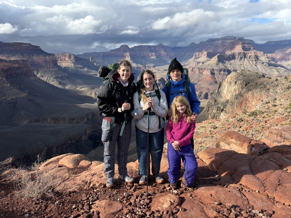
Right after Christmas, we decided to take a quick backcountry trip to the bottom of the Grand Canyon. We had only been to the Canyon once before during our COVID summer roadtrip, but had never ventured more than 2 miles down the Bright Angel trail.
We flew to Phoenix and drove a rental car to Tusayan, a cluster of hotels about 3 miles south of the park entrance. That evening, I drove into the park to pick up my permit from the Backcountry office. The ranger was very helpful and confirmed that water would be on at the Bright Angel and Havasupai Gardens campgrounds. The next morning, we woke to miserable weather: 33 degrees of rain, with the occasional wet snow flurry. We decided to start late, hoping the weather would clear. After hitting up the Tusayan Starbucks, we waited in line to enter the park and drove over to the parking lot by the Backcountry office in the Grand Canyon Village area of the South Rim. The Ranger had recommended the night before that we park in this lot because, even though it would require buses to reach the South Kaibab trailhead on day 1, it would be a short walk from the top of the Bright Angel Trail when we finished on day 3.
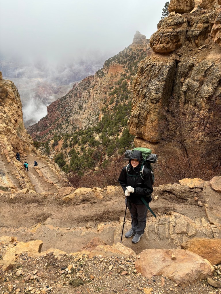
We boarded the shuttle bus in a snowstorm, the driver incredulous that we were going down into the canyon. At the South Kaibab trailhead, the snow continued, with almost no visibility. We started down the muddy trail in good spirits. I made everyone wear rain pants given the precipitation, and it was a good call.
We took a quick water break at Ohh Ahh point, about a mile down the trail, then a longer break at Cedar Ridge, about 1.5 miles in.
There are pit toilets at Cedar Ridge, and we enjoyed some views of the Canyon as we were now under the cloud deck.
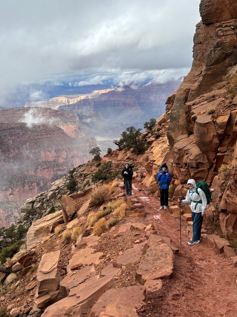
From Cedar Ridge, the slippery trail continued to Skeleton Point, which is a dramatic promontory with views of the Canyon dropping steeply from three sides. About this time, a rainstorm rolled in, bringing with it strong winds and a beautiful double rainbow.
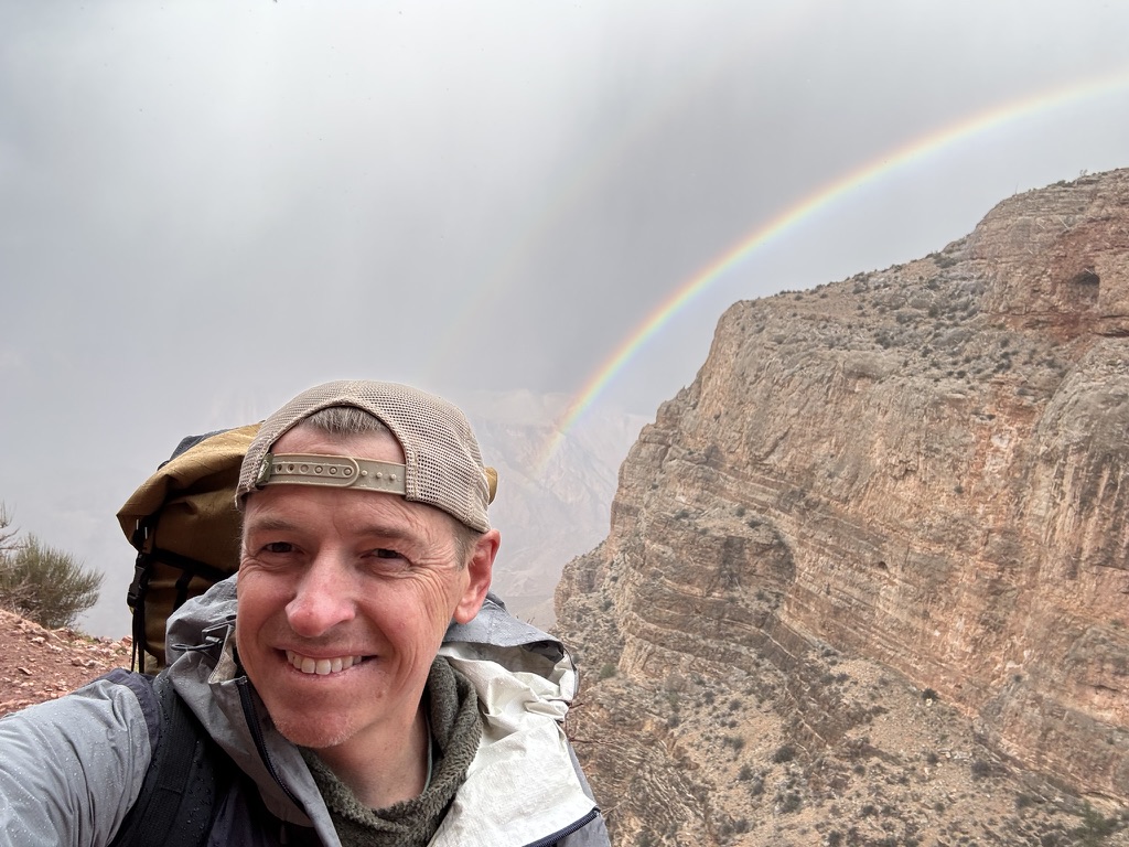
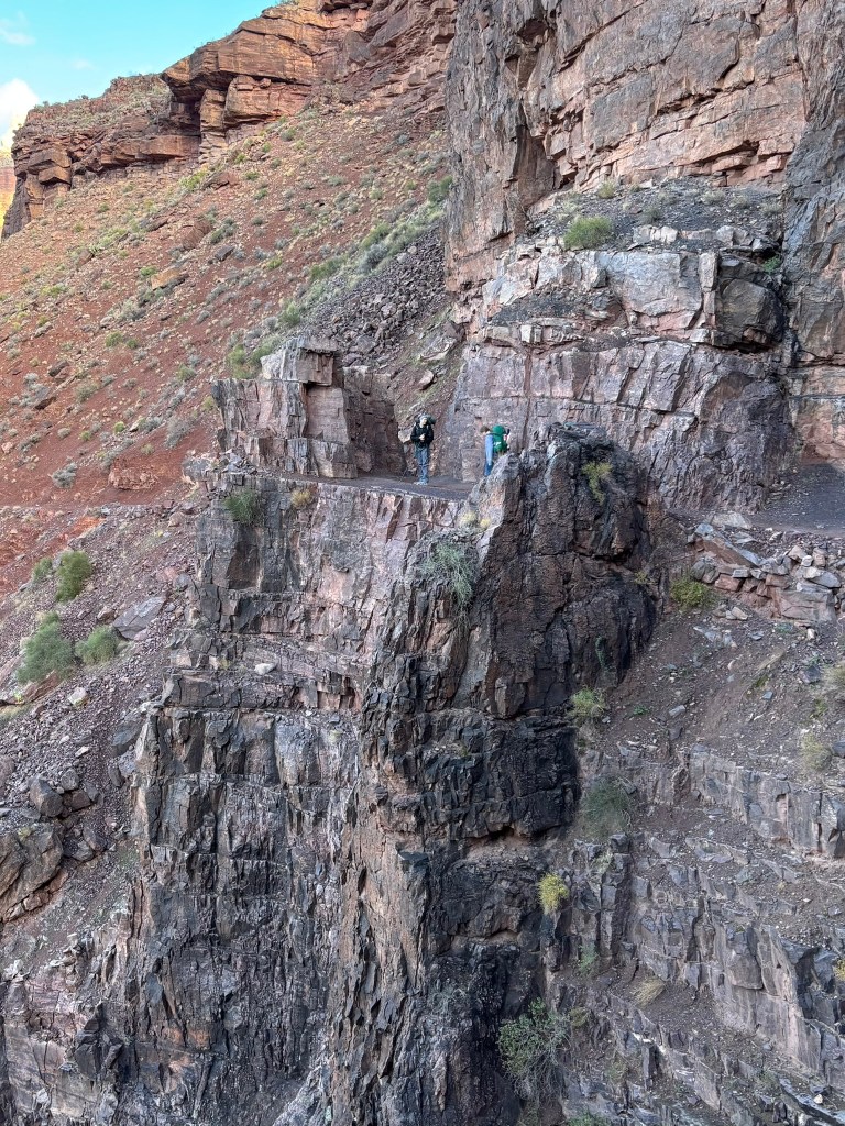
One thing that surprised me about the trail was its significant exposure in some spots. The trail is wide and well constructed, but the area around Skeleton Point has several spots where, if one were to fall off the trail, it would be fatal.
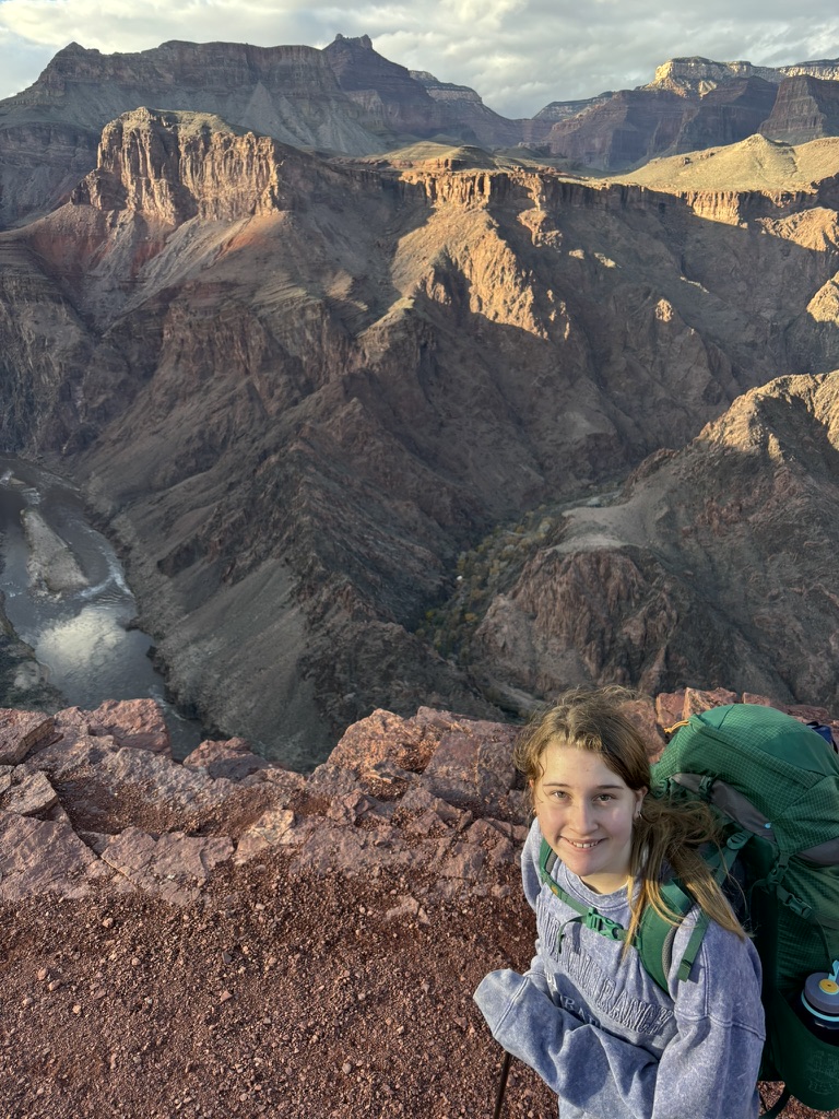
The kids took everything in stride, and we only had a real problem when we were almost down to the Tonto Platform and passed a sign saying we had gone 3.5 miles but still had 3.8 to go to Phantom Ranch. I had told everyone that the hike was about 6 miles, and some in the group did not appreciate the additional 1.3 miles. But six-seven!
After descending the switchbacks from Skeleton Point, the slope is relatively gradual to the Tip Off shelter and bathrooms, where we took another break. This is where the Tonto Trail, which goes east/west, intersects the South Kaibab Trail, which goes north/south. The Tip Off itself is about 200 yards from the shelter and offers the first really good views of the Colorado River. The 1.8 miles from the Tip Off to the River are the steepest part of the trail, and with high-mileage knees, it was the most uncomfortable stretch.
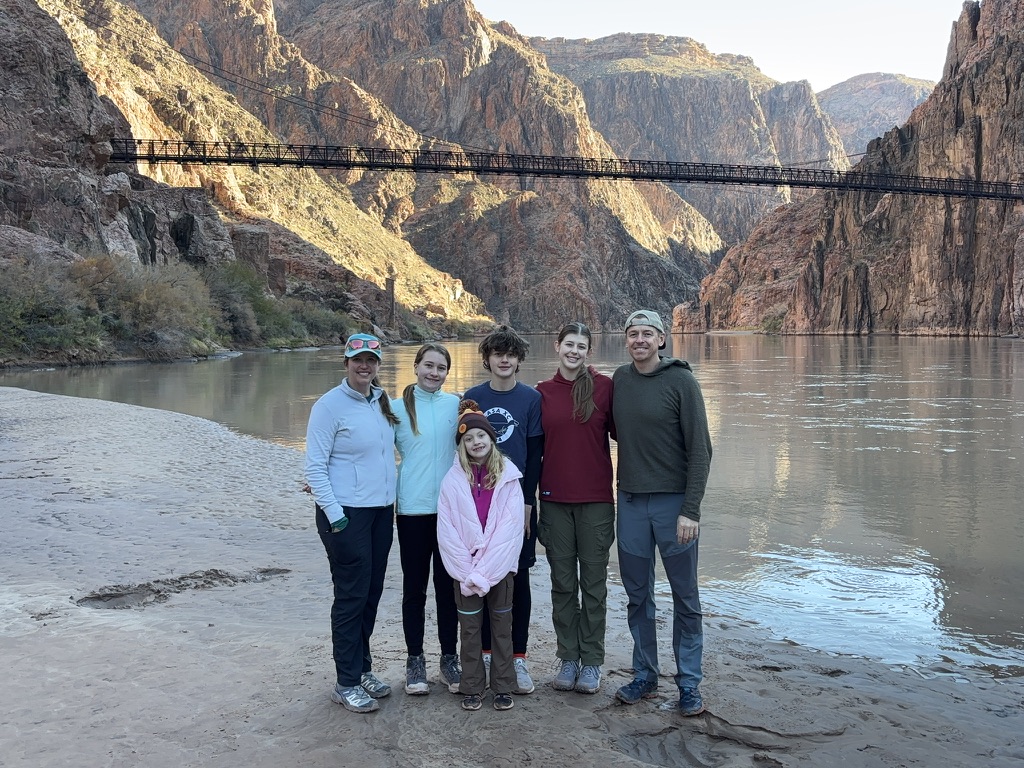
At the bottom, the trail passes through a tunnel and then crosses an iron suspension bridge, the Black Bridge, built in 1922.
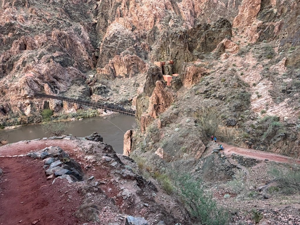
From the bridge it is a short walk to Bright Angel campground. We selected our campsite, and hurried to set up the tents and cook dinner before dark. We ate dinner and were playing Uno when a Ranger came by to check our permit. She also told us that the Phantom Ranch Canteen is open from 8:00-9:30 pm every night for those who want to buy a drink or just get in out of the cold. We really appreciated this tip, as we took hot chocolate packets for the kids to drink while they played Jenga and Michelle and I had a glass of wine. Phantom Ranch is such a neat historic spot.
That night, the temps dropped into the 30s, but everyone slept well. But in the morning us oldsters needed some vitamin I as the legs were quite sore from the downhill. We had coffee, ate breakfast, then hit the bathrooms (which have actual running water – amazing in the backcountry!). Our first stop was the River, which we all wanted to touch to prove that we made it to the bottom of the Canyon. It was clear and still, and the muddy river was spectacular.
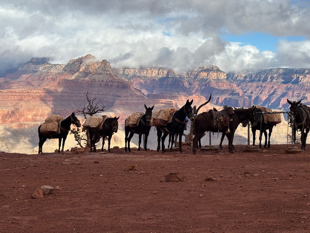
The steep hike up to the Tip Off took about 2 hours, but frankely going up is easier than coming down. At the Tip Off we ate lunch in the shelter and saw a pair of Big Horn Sheep wander a few hundred yards away.
Currently, the NPS is replacing the water line that serves the South Rim. Due to the construction, the River Trail was closed, meaning the only way to reach Havasaupai Gardens from the South Kaibab Trail was to take the Tonto Trail. The Tonto trail is, relatively flat, and follows the Tonto Platform, which is a wide bench about 3,000 feet below the South Rim. We were on it for about 4 miles, and enjoyed the views as the trail meandered into the Pipe Creek Canyon.
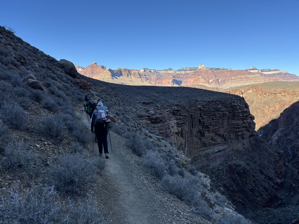
We took a break at the creek and filled water bottles, then continued on. The Tonto Trail also had several places with significnat exposure to falls of many hundreds of feet. Along the way, Sam found a curious rock which appeared to contain a fossil (which we left where we found it on the side of the trail).
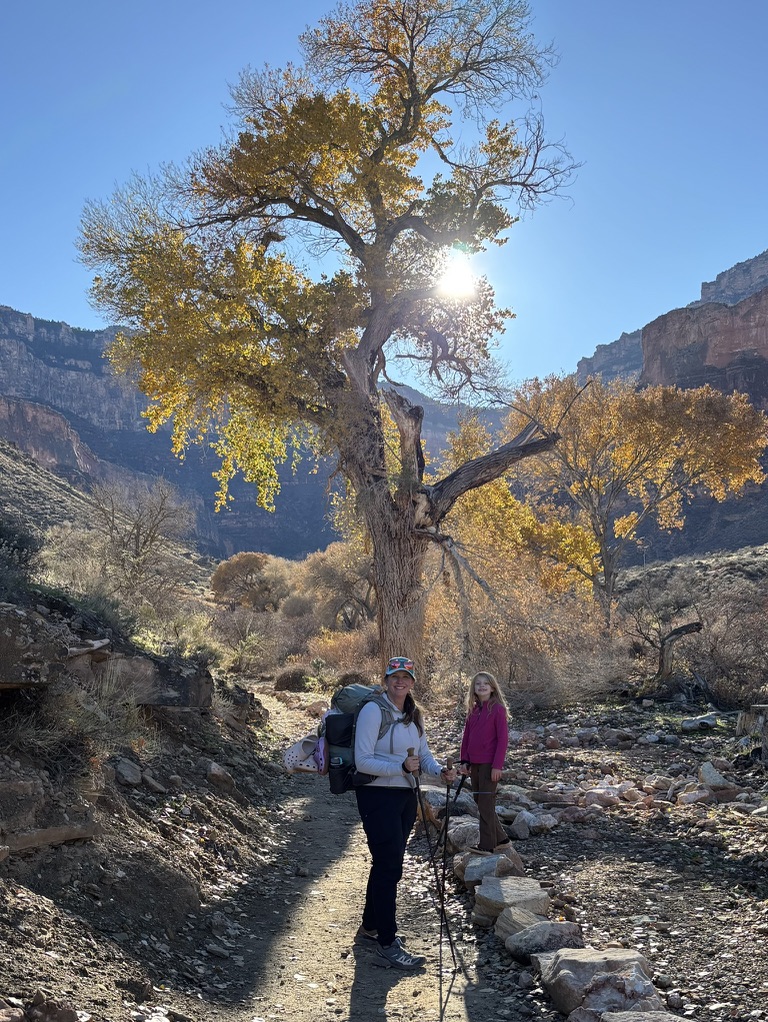
We arrived at Havasuapi Gardens Campground around 3 pm and selected a large site to accommodate our tents.
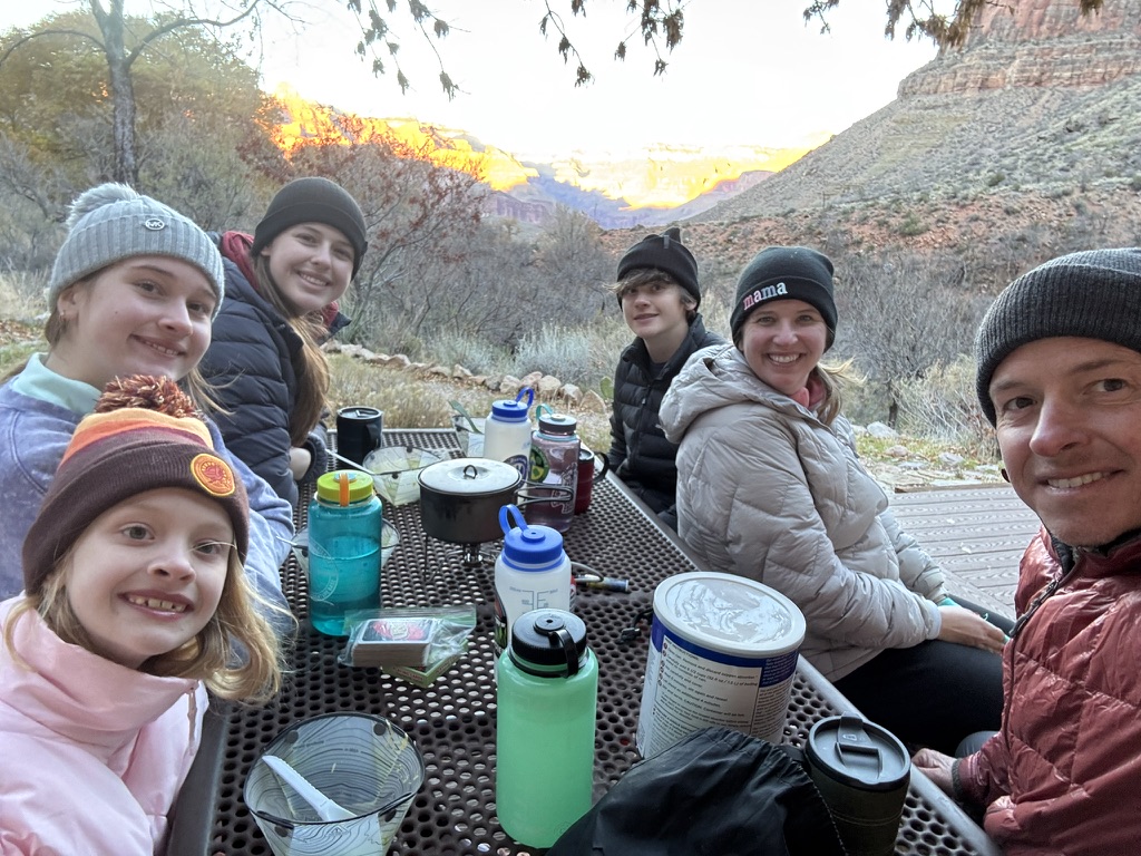
The campgound is next to a small creek, and the sites are set amoungst trees. The Ranger at Phantom Rach had advised us that we could use the picnic table on the deck of the Ranger cabin for dinner. We ate dinner there while we watched the sunset on the rocks of the North Rim.
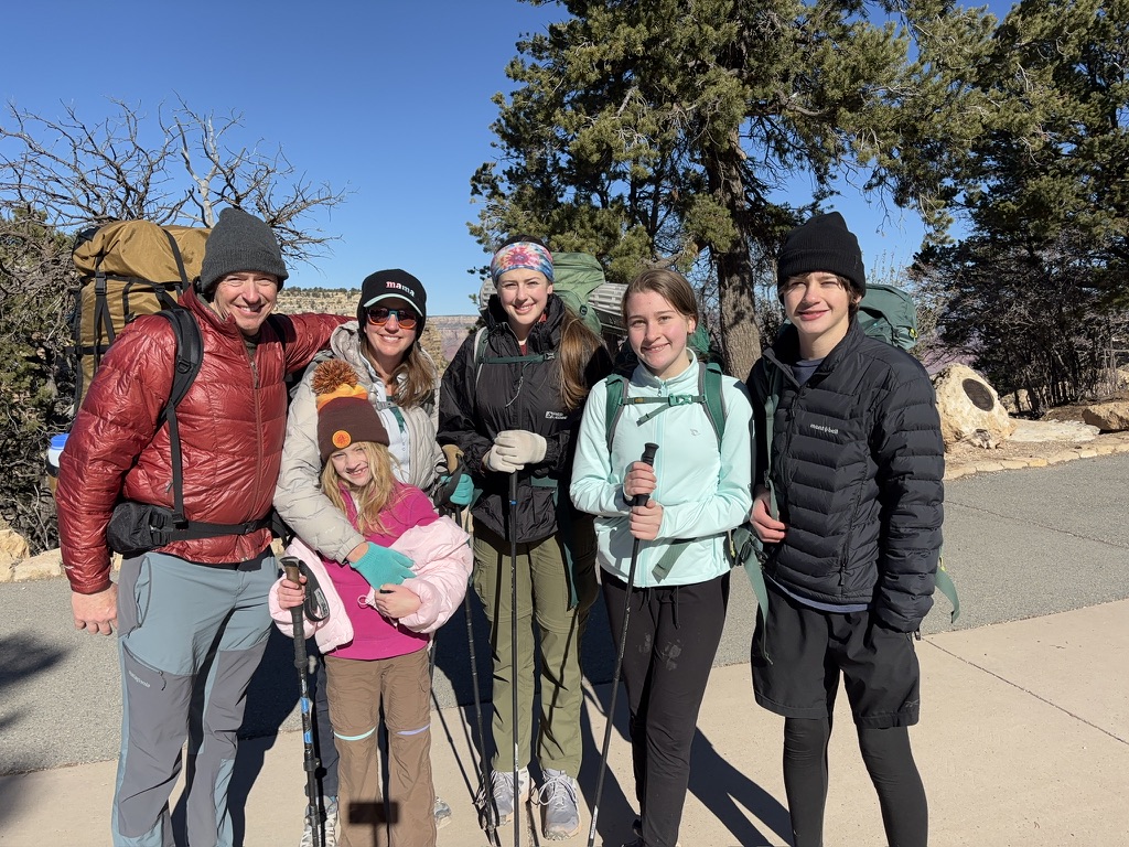
That night it was cold, with temps in the 20s. When we woke up the weather was clear but windy. We quickly had coffee and packed up and started the 3,000 foot climb up the Bright Angel trail. From Havasuapai Gardens, the trail appears to dead-end into vertical cliffs, but it winds around. We took our first break at 3-Mile Resthouse, with the temps dropping as we gained altitude. We took another break at 1 1/2-Mile Resthouse, and finished out snacks. From that point forward we were beginning to see more people on the trail. Once we were up to the last half mile, the trail was pretty crowded, and the wind was gusting. When we reached the top of Bright Angel and stepped onto the sidewalk, there were thousands of people and it was as if we had been transported to a cold, windy version of Disney World. We took a victory photo and headed to the car.
We stopped by the Visitor Center on the way out to see the big 3D map of the Canyon and realized that, in our 20 miles of hiking, we had covered a tiny fraction of the park. It was humbling. With everyone cold and the crowds unbearable, we decided to head back to Flagstaff, where we celebrated a victory feast of hamburgers and milkshakes.
Logistically, the challenge with this type of trip is getting the permits. Corridor campgrounds, including Bright Angel and Havasuapai Gardens, are available through a Recreation.gov lottery a few months in advance. The weather, although cold, was actually great for a backpacking trip – certainly better than summer with temps over 100. We brought microspikes and trail crampons, but did not use them when there was significant snow or ice.
As far as backpacking gear, a standard ultralight approach works. Potable water is available, and we each hiked with just 1L for most of the time. There are lots of pit toilets, and we never had to use a shovel. The ground at the campsites is solid, so tents that rely on stakes work well. The trail’s difficulty is manageable for those in reasonable shape. Our nine-year-old hiked without a pack and had no trouble. The rest of the kids carried full packs. The trails themselves, although they cover a lot of elevation, are very well built.
Finally, it should come as no surprise, but the Grand Canyon is really Grand. Its beauty cannot be captured in a picture. As one hikes down, one moves through hundreds of millions of years of geologic history, with the rocks along the Colorado River being almost 2 billion years old. The scale is enormous, as you can literally see for miles without human-scale references. Next time I go back, I hope to explore some of the off-corridor backcountry. But for a quick, relatively convenient, and awesome trip, its hard to beat a few days hiking in the Canyon.
